Quick Links: A Century on 55th St. | A Century on 63rd St.
The Chicago Centuries Project is an ongoing research initiative of Chicago Studies. The project's principal goal is to gain granular insight into (and map/represent) ten decades of changes in the South Side neighborhoods that surround the University of Chicago, including those due to changes in transportation patterns, the Great Migration, redlining and residential segregation, suburbanization, urban renewal, and civic (dis)investment. The project engages undergraduate researchers -- each of whom receives training in Chicago-specific historical research -- to painstakingly document the history of an assigned block, including its buildings, inhabitants, and businesses, from 1920 to the present day. Their findings contribute to an open-access dataset, GIS map series, and digital archive (all still in production) that will serve as stepping-off points for future classes, public programming, oral history gathering, etc. Chicago Centuries has also collaborated with Expositions Magazine (a student publication of CEGU, UChicago's Committee on the Environment, Geography, and Urbanization) to publish stories from A Century on 55th Street in Fall 2023, and from A Century on 63rd Street in Fall 2024.
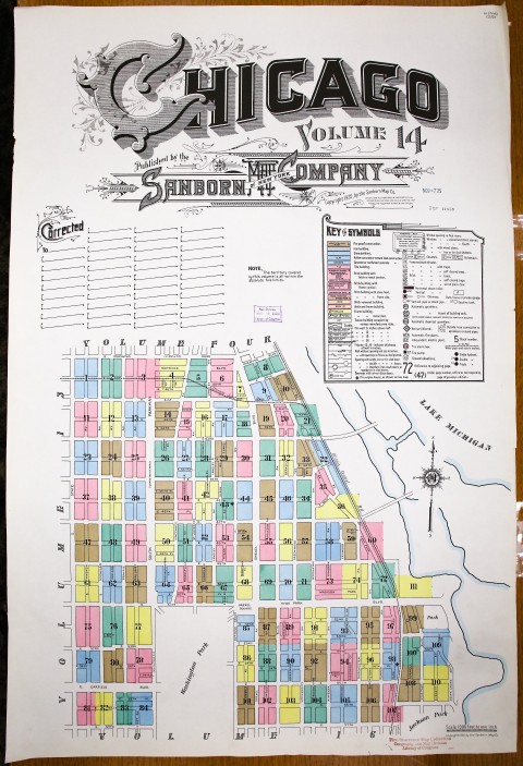
Participants in Chicago Centuries learn to use an array of resources to investigate un-preserved historic sites in Chicago, including historic fire insurance maps, building permits and tax records, US Census records, historic photographs, digitized and archival print materials, resources from Chicago-area special collections, and the archives of Chicagoland newspapers. Many researchers have gone on to apply these skills to independent research projects (e.g. historical BA thesis papers or class projects). Some have translated their experience with Chicago Centuries into employment opportunities as well, supporting the work of Chicago-area historical societies, historic preservation groups and consultancies, and even the Chicago History Museum. Of particular note is the work of Centuries' now graduate student research coordinator and GIS specialist Parker Otto (AB '24), who has developed increasingly sophisticated techniques for digitizing Sanborn Fire Insurance maps (see his recreation of 1926 Hyde Park) to better understand and represent the past century of changes to the South Side's built environment. Parker is now presenting and publishing about these innovations for academic and professional audiences, all while continuing to help our undergraduate mapping team apply them to Centuries' work.
Beyond its historic and educational benefits, Chicago Studies has undertaken the Chicago Centuries Project in the hope of encouraging broader knowledge of and deeper reflection on our own institution's role in (re)shaping the histories of Chicago's South Side communities. Although an academic institution with global reach, UChicago's work has always arisen in relation to a specific set of places: residential neighborhoods, commercial corridors, and community areas of the city of Chicago and the Chicagoland region. Many of our seminal contributions -- to history, sociology, geography, social work, urban theory -- were developed by studying Chicago and its residents; at times, the theories that emerged from those studies were applied back to the communities that co-created them, labeling them as "blighted" and targeting them for demolition, "renewal," and displacement (in patterns that, at times, also contributed to the growth of the University's landholdings and its economic control of the region). We necessarily work in the legacy left by these interactions, both creative and destructive; we hope that better understanding our past century will leave us more accountable, more respectful, and more cautious as we continue to think and work here.
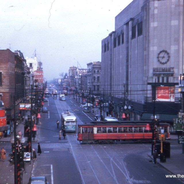
Hero image: View looking west along 55th Street at South Lake Park Avenue in 1955. University of Chicago Special Collections [apf2- 03950], Special Collections Research Center, University of Chicago Library.